 We left Fairbanks on Friday, July 25th and headed to Tok. That’s about 200 miles and we boondocked two nights en route—we are in no hurry.
I'm always amazed by the early pictures and the fact that people walked up here—and had to take their goods with them! They were truly amazing people.
Tok (rhymes with poke, joke, and Coke) is where we completed our Alaskan “circle.” We first arrived in Tok going north on June 5th and started wending our way around Alaska from there. We went south to Valdez, ferried to Whittier, then the Kenai, back up to Anchorage, through Denali to Fairbanks, and here we are again. For anyone visiting Alaska by vehicle, Tok is frequently mentioned in the tourist magazines and online as the only city you will have to visit twice. It is the first city/town in Alaska after you cross the US/Canadian border and the last one you visit on your way back. There is no other driving route. It’s about 90 miles from Tok to the international border.
Also, Tok is where we start to backtrack over the same route that we drove north (ALCAN Highway)—Note: the ALCAN is officially called the Alaskan Highway now. We will backtrack to just before Watson Lake (about 650 miles) where we turn off the Alaskan Highway to go south on the Cassiar Highway. The Cassiar will be a new route back for us.
We finally crossed the border on July 30th meandering south. As is our usual luck, we got searched again at the Canadian crossing. Two Canadian Customs women went through my underwear drawers and about everything else—even looking BEHIND drawers. No, there was nothing for them to find. Must be my sinister looks.
 You may recall from my earlier northbound blog that the 127-mile stretch of highway from the border to Burwash Landing, YT is famous for being miserable due to the frost heaves. I don’t know if we were imagining it but it seemed a lot rougher on this return trip. It could be that the increased summer traffic negatively affects them. I had my cruise control set at 45 mph and slowed for every frost heave I could spot—there were thousands of them. Luckily, we weren’t concerned with making time!
Here is a photo of some frost heaves. I didn't know if I could get a shot or not. The light had to be just so-so, I had to actually be able to see them, and have time to stop the coach. They are often virtually invisible.
 There was no traffic when I spotted these frost heaves so I stopped in the road and took the shot through the windshield. I added the arrows so you can better see what I’m talking about. The single flag means this is the worst side—often, an axle-breaking dip. Flags on both sides means it stretches across and is equally bad in both lanes. You quickly learn to watch for and have absolute faith that these flags mean something! Many of these smooth-little-humps will launch a car at about 60+ mph so it really shakes up a motorhome. Your front end sure seems like it is coming off the highway! Slow is the only answer and slow is defined at about 25-35 mph when you cross the frost heaves.
In the picture, you actually see three of the humps. If humps happen to be spaced out just right, your speed is just right, and your wheelbase is just right, then multiple humps will actually increase the negative effects with successively higher launches of your vehicle. Think of it like warming up on a trampoline with successively higher bounces!
 Whitehorse, BC
In Whitehorse, we got a campground and were packed in tight with three caravans. The caravans pulled out the next morning so the place was mostly deserted. My satellite dish worked so we have Internet, the cell service was nonexistent, and cable TV brings in some Seattle stations.
This was an unusual campground about 3-4 miles outside of the city. They had a lower portion where they packed in the RVs. It was really tight side-to-side, no frills, and open—no trees on site. They had an upper area (we drove it and easy to maneuver) where the sites were private, treed, and quiet. Interestingly, almost no one was up there (same cost).
 We stayed here for five nights. There’s lots of stuff to see in Whitehorse with several museums. Two unique things are the weathervane at the airport (seriously). It is a full-size DC-3 aircraft, mounted so that it turns and faces into the wind. Impressive!
 They have what is supposed to be the longest fish ladder in the world here. We visited it the first day (6 days ago) but no salmon (they even have video under water). Went back today and they told us there were a few gathering but had not attempted the ladder yet. I heard from another RVer that they were catching some in the Kenai. At this point, I just want to see some!!!
 We were just driving around and followed the river some distance out of Whitehorse. There are some spectacular views but no salmon.
Whitehorse is a small city, it's easy to get around, everything is relatively close, and (of course) they cater to tourists—RVers are definitely tourists. We discovered that if you go to the city administration building, they will give you (the tourist) a three-day parking pass. It's good at all parking meters and city parking lots and was really handy for us.

 There are lots of things to see in the area and one unique one was the Old Log Church. It was actually a museum inside.
We both love any wild game—both to view it in the wild and to have it on the table. A deli (called, "The Deli") in Whitehorse was suggested for lunch and we went. This was also the home of the Yukon Meat Company. We had a great lunch and then purchased some reindeer sausage and bison when we have dinner on the road later. We will eat this before we cross the USA border as I do not know if they will allow it across.
We also got tickets for the "Frantic Follies"—a vaudeville production that was fun and certainly entertaining. It took place in a small "showroom" in one of the hotels. Worthwhile. It is a common stop for the caravans.
Sure enough, I get chosen to go up on stage (I get chosen all the time.) Most of the time it just happens. Why, I don't know. But occasionally, I do know... Once, we were on a cruise, and my friend David Greer, shoved my arm into the air when they asked for volunteers for a cooking demo. (I cooked.) I don't want to be a spoilsport but would rather see the show than be in it!


The Steamship Klondike was also a great tour. Owned by Parks Canada (their equivalent to our National Park Service), they have a guided tour throughout the steamship. It was really well done. This boat was the largest on the Klondike River and was 230-feet long. It only required 6 feet of water to maneuver!
Sailing on the Klondike was either first class or no class. You didn't want no-class since this required you to sleep with whatever stores they were carrying.

Driving the Cassiar Highway
We pulled out of Whitehorse and headed east toward Watson Lake. Our next route turns south about 12 miles west of Watson Lake so we actually did not go all the way back into the tiny town. We turned onto the Cassiar Highway about 12 miles west of Watson Lake.
 There was an instant change in highway. The first 25 miles was with the cruise control set at 40 mph and LOTS of 15-20 mph driving due to LOTS of gravel from LOTS of patching and resurfacing—sometimes 6-7 patches per mile! Some were long 300–400 yards but most were short stretches of gravel (100–200 feet). The frequent short pieces of "good" (untouched) highway would not provide enough space/distance for you to pick up speed. We thought, oh well, it's only a 375-mile drive to Stewart/Hyder!!!
Got through the rough stuff and found that this highway is like one notch lower on the highway scale than the previous one. It is two-lane, no guardrails, no shoulder, with 6-50-foot drop-offs, with occasional lane lines painted on the highway. The RCMP had a travel trailer stopped for something but since there was no shoulder, they simply took up the right lane. But, there was little or no traffic.
About 75 miles down the Cassiar, we stopped at a tiny place called Jade City (two small buildings) to look at the jade (they mine 75% of the world's jade here). Chatting with the workers, I asked where they bought their groceries. They didn't bat an eye and simply said, "Watson Lake!" This means two things... they have to drive 87 miles one way to the grocery in a town of 1,200 (and don't forget about that 25-mile stretch I described above)! And second, they are nuts. The good news is that Jade City has free overnight RV parking. We didn’t stay there but it looked nice enough.
 We drove 120 miles the first day on the Cassiar. Nice scenery—much like Yellowstone—with a bit of snow on the fairly short mountains that sort of close in on the highway. We are next to a lake and the loons are looning. Mosquitoes, too. For the last few days, they have come out—in droves. Open the window and 100 will be on the screen. Two or three seem to be getting in the coach at night—must have a hole somewhere.
We spray the bedroom, close the door, then the bathroom, and close the door about an hour before we go to bed. Then, when we go to bed, we spray the front. This has helped. Think of it as living with "Raid."
Route 37A or Turning West to Hyder/Stewart
 This highway takes you off the Cassiar and toward the coast where the two towns of Hyder, Alaska and Stewart, BC are situated side-by-side. Neither is a metropolis with Hyder at about 100 residents and Stewart about 500.
This route is about 35 miles long and is considered one of the most beautiful and spectacular in all of British Columbia—and that's saying a lot! The Bear Glacier, waterfalls, beaver dams, mountains, and streams mark your way. It is one great drive.
 The ground here (in many places) is solid rock. So the drilling or placement of poles for electricity is virtually impossible or cost prohibitive. Rock is everywhere—big and small. They solved their power pole installation problem with the local rock. These piles were 15-feet tall and some of the rocks were half the size of a car! Hey, it works.
Interestingly, this stretch of highway is good—even better than much of the Cassiar. My assumption is that it is maintained for the tourists (RVers).
Stewart is the first tiny town you come to going west. Laid out in a grid, it is easy to get through. You will see a couple of restaurants and gift shops while driving through. If you are a shopper/browser, this is not going to be your best day.
Stewart also has a free dump station fully accessible to all. It is easy to get to, plenty of room to maneuver the biggest rig, and was clean. I believe there was potable water available, too. We didn't need it so I'm just not sure.
 This huge snow mass was impressive in August! It had to be from some earlier avalanche but whatever the source, it dropped a lot of snow here! Notice the small, black, cave-like hole in the bottom center of the snow. This is where the melted snow is actually running out into the stream. To help you gain a little perspective on the size of this giant pile, I could easily fit my coach inside this cave!
 Here's the Bear Glacier. There was some road construction along here but we still had plenty of space to pull off and take the shot. Spectacular! Years ago, the glacier reached across where we are parked. The highway could not be built until it had melted back some.
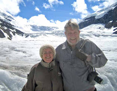
Hyder, Alaska


Hyder is one of the very few places where you can enter the USA from Canada and there are no border guards. None whatsoever. But, if you intend to drive out of here, you will have to backtrack on this same highway where there is a Canadian border checkpoint. Also, there are no paved streets in Hyder—all the streets are gravel. Interesting.
 We stayed in Hyder at Camp Run-A-Muck (seriously). You have to understand, Hyder ain't all that exciting... we had a beer in the ONLY bar in town and then ate at the ONLY restaurant in town. (There used to be two but the other cook took a motorcycle trip—seriously—and the kitchen closed.) Camp Run-A-Muck was busy with a caravan, had 30-amp, water, and just a few sewer-hook-up sites on a septic system. The manager asked if we could get by without sewer and we said sure. She said we could dump in Stewart. Everything worked out fine.
 The restaurant was named "The Bus" because the woman who runs it (her husband is a fisherman) cooks in an old school bus (seriously) and then brings the food out the door. There were two seating areas—outside and inside. We both had fish and chips. The fresh halibut was wonderful. It’s amazing what you can do in a school bus.
 There’s only two steady, fulltime jobs in town—the postmaster and the teacher. Hyder, Alaska is so close to Stewart, BC (3 kilometers) that the only clock in town on the official Alaskan time is the post office. Everything else just functions on Pacific time to match with Stewart.
 Like Stewart, Hyder is situated on the water. There was even a boat out there!
 A Note About Bears and Salmon... We finally saw some salmon—just a few but I hated the thought of doing this whole trip without seeing any. The problem was the late summer and the resulting late snow melt. This caused the streams to be thick with glacial silt and several degrees colder than normal for the salmon run. So, we did not see one. When we were here in Hyder, we talked to a man whose friend was in the Kenai and they were having a great run. The problem was that it was about 5 weeks late.
The main purpose for us coming to Hyder was the Fish Creek area. This is a built-up wooden, deck-like area where tourists can walk out and see the grizzly bears catch and eat fish. You are protected from them. They are protected from you. Everything is as it should be. We have seen at least 15 TV shows about how the bears do it and we just wanted to see it. So, we came to Hyder.
Luckily, we saw a grizzly chase down one salmon and catch it. The bear spent some time on shore in front of us just eating away! Just like on TV. Fascinating.
 All in all, we saw maybe 20 salmon. That's it, for the entire trip. It was the single negative thing on this great trip!
We left Hyder after two nights. It's about 475 miles to Prince George and we will spend three nights on the road getting there. Since we have been on the Cassiar Highway, my cruise control has been set to about 45 since we don't know what kind of highway is ahead of us. No hurry anyway. Lots of wildlife on the road around here so there's plenty of reasons to go slower. We see black bears frequently.
Winding Down?
We are not tired of the trip at all but we are both pretty tired of no TV. We brought a tub full of movies (borrowed) and had about 30 shows recorded on the Tivo but we have gone through everything two or three times. We also brought a bunch of books because we read every day/night. We generally plan on getting back to the coach (or finishing with dinner) about 2100, watch some show/movie (kill a couple of hours), and Sandy hits the bed. She's been sleeping in (rare for her but no morning TV to watch) and we both get up by 0800. We get our news at abcnews.com.


No comments:
Post a Comment